Natural Resources Canada

Committed to improving the quality of life of Canadians by ensuring the country’s abundant natural resources are developed sustainably, competitively, and inclusively.

On This Page

Natural Resources Canada (NRCan) is a GEO.ca partner, leading work in the field of geomatics for priorities including emergency mapping, forests, geology and geophysics, mines and minerals, and topography. Access data and services from some of NRCan’s geospatial contributors to GEO.ca and geospatial-related initiatives.

NRCan Featured Geospatial Contributors

Find more resources for geospatial information from Natural Resources Canada.

Canada Centre for Mapping and Earth Observation

Within NRCan, The Canada Centre for Mapping and Earth Observation (CCMEO) responsibilities include data integration, innovation, analysis, management, and dissemination of a wide selection of geospatial data and mapping products.

Products

The Canadian basemap of transportation along the border of Quebec and Ontario showing roads, place names, water, and vegetated and urban areas.
Basemaps

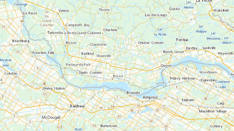
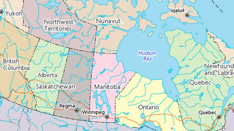
The Canada Transportation Basemap provides a geographical background for mapping and visualization, with a focus on transportation and official bilingual place names.

The Atlas of Canada's map of the world poster.
The Atlas of Canada

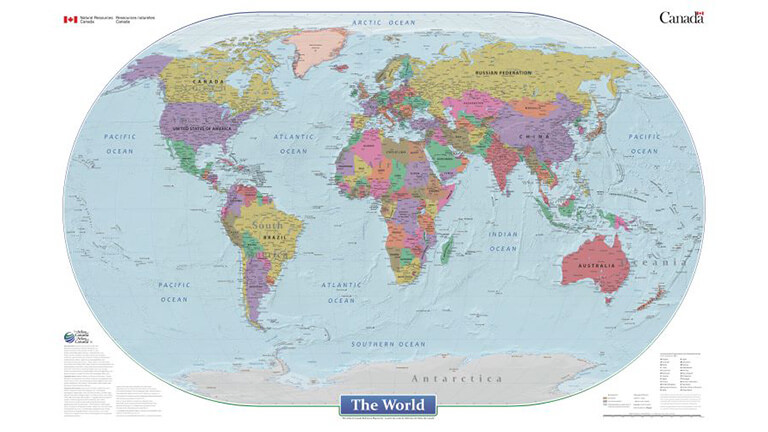
A key source of geographic information, the Atlas provides a selection of interactive, static and historical maps and geographical data available for reference or downloading

Color shaded relief map for a mountainous area near Jasper National Park.
High Resolution Digital Elevation Model

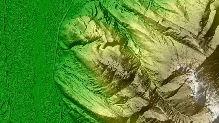
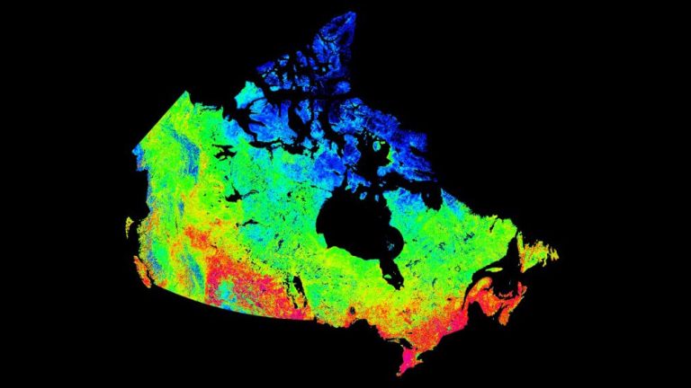
The High Resolution Digital Elevation Model (HRDEM) is highly detailed 3D information providing essential foundational geospatial data for many government projects and priorities.

Services

Image of Earth view from space
Earth Observation Data Management System

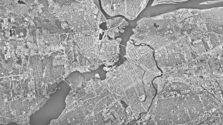
Discover, access, and download satellite imagery including Long-Term Satellite Data Records, and millions of air photos from the National Air Photo Library (NAPL).

Simple grey map of Canadian geographical place names in part of Nunavut
Canadian Geographical Names Database

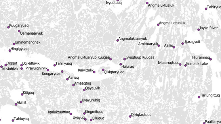
Access nearly 350 000 currently approved geographical names stored on the CGNDB, Canada’s national bank of official geographical names.

Partial map of Canada with provincial and territorial names and borders.
Toporama

Toporama is a dynamic mapping tool to view Canada at a national, regional, and local scale. Use it to search for places, manage layers and more to create a custom map.

Innovation

A satellite in space
Data Cube

The Data Cube platform allows users to interact with historical and current collections of satellite imagery and aerial photography products.

Artistic visualization of a digital system
Geocore (Cloud-based Geospatial Search)

The geocore geospatial library is an open source, cloud-first solution for search, discovery, and dissemination of geospatial content.

Map of floods near Fort Chipewyan Alberta.
Emergency Flood Mapping

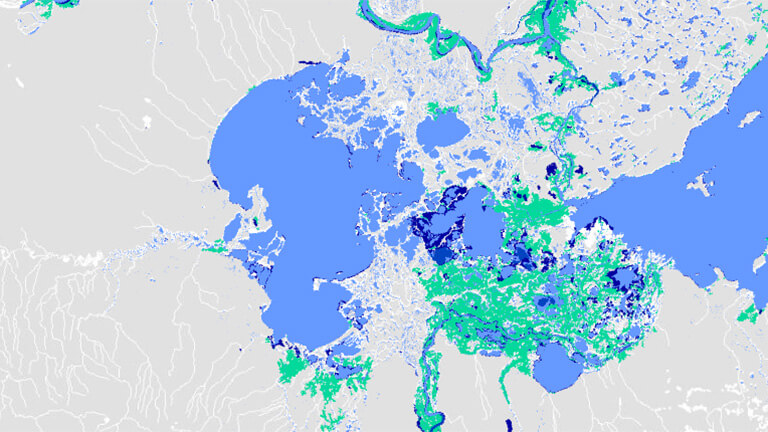
NRCan’s Emergency Geomatics Services (EGS) provides critical, near real-time information to Public Safety Canada and emergency responders during ice break-up and flood events.

Standards

CCMEO leverages the standards-based technologies and operational policies of Canada’s spatial data infrastructure, the Canadian Geospatial Data Infrastructure (CGDI). The CGDI’s base of standards, policies, applications and governance facilitates the access, use, integration and preservation of geospatial data and services for all Canadians.

NRCan Featured Geospatial Programs and Initiatives

Explore our featured initiatives below as we introduce you to some of the great projects, technologies, and ideas that NRCan is working on to create a stronger open source for geospatial resources for all Canadians.

Flooding is Canada’s most costly natural disaster. Each year, it causes an average of over $1 billion in direct damage to homes, property, and infrastructure. Natural disasters are increasing in frequency and severity. Canadian federal, provincial and territorial geospatial data providers are collaborating to provide tools and resources to help Canadians plan and prepare for floods.

Open Science and data to inform cumulative effects

Environmental and socio-economic changes, caused by the combined effects of past, present and potential future human activities and natural processes, can accumulate and combine across space and time. We refer to these as ‘cumulative effects’. The Government of Canada’s Open Science and Data Platform, co-led by NRCan and Environment and Climate Change Canada, provides access to science and data that can be used by Canadians to understand the cumulative effects of human activities.