Permafrost by territory
Discover the implications of permafrost across contributing territories in Canada.
Discover the implications of permafrost across contributing territories in Canada.
Home / Communities / Permafrost / Permafrost by territory
Mapping Thaw Slumps in the Northwest
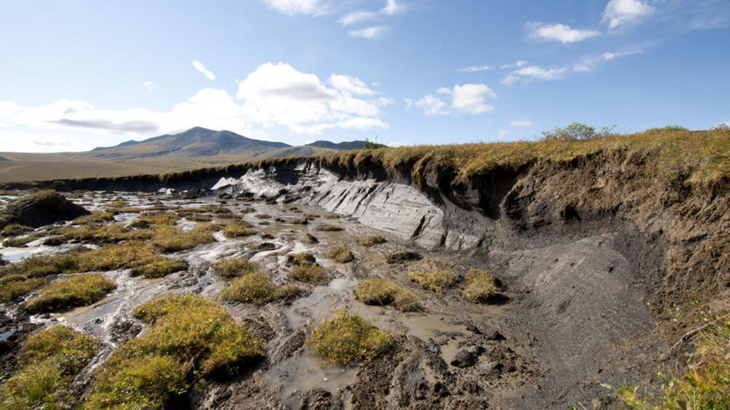
Thaw slumps are landslides that take place in permafrost regions where the ground contains large volumes of ice. Unlike most landslides that develop quickly, these slumps grow slowly every year as the ground becomes exposed to the sun during the summer. Thaw slumps threaten Canada’s northern infrastructure and contribute to vast quantities of sediment and dissolved materials to water.
Gwich’in and Inuvialuit residents of communities in the Beaufort Delta region have reported an increase in the number of slumps, which has had consequences for travel and traditional hunting and fishing activities.
Using satellite imagery, Indigenous partners, scientists from the Northwest Territories Geological Survey, and the NWT Centre for Geomatics have mapped the abundance of thaw slumps and other permafrost landslides across northwestern Canada.

Mitigating Degradation to the Alaska Highway
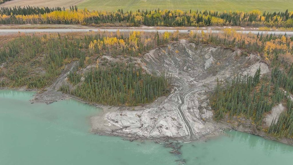
Near Whitehorse, a permafrost thaw slump has been growing closer to the Alaska Highway since 2014 at rates up to 19 m per year. In 2023, the highway was rerouted about 80 m back from the landslide to mitigate concerns that the landslide might damage the road. Researchers at Yukon University are working with Yukon Government to monitor the site, ensure public safety, and protect the only year-round road linking parts of the Yukon and Alaska to the rest of the continent.

Ready to collaborate?
Email geoinfo@nrcan-rncan.gc.ca and get in touch with our team.
GEO.ca is committed to open dialogue and community building around location-based issues and topics that matter to you.
Share this page:
Canada Centre for Mapping and Earth Observation
Natural Resources Canada
Government of Canada
geo@nrcan-rncan.gc.ca

Terms and Conditions
Powered by GEO.ca, Copyright © 2026
GEO.ca is part of the Canadian Geospatial Data Infrastructure (CGDI)