Flood Mapping

Canadian federal, provincial and territorial geospatial data providers are collaborating to provide tools and resources to help Canadians plan and prepare for floods.

About Flood Mapping in Canada

Flooding is Canada’s most common and most costly natural disaster. Overall, the estimated average annual cost of residential flooding in Canada is $2.9 billion. Natural disasters are increasing in frequency and severity. For more information, please visit: Adapting to Rising Flood Risk

A flood hazard map showing the results of hydrologic and hydraulic investigations.

Learn About Flood Mapping

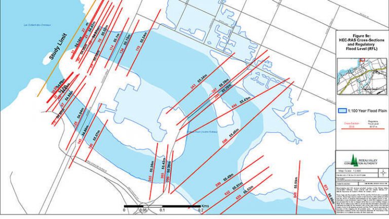
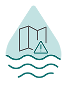
Flood maps show an area that may be covered by water, or show where the water reaches during a specific flood event. They are critical tools that can help us identify potential risks and mitigate flood impacts.

Photo of Canadian Flag and Parliament Hill Ottawa

Flood Mapping and the Government of Canada

The Government of Canada is investing to help Canadians better plan and prepare for future floods. Learn how the Government of Canada contributes to the production of flood maps.

A rock sculpture and a canoe on the shore of a lake with a mountain in the background.

Flood Mapping in Your Province or Territory

Provinces and territories are responsible for undertaking flood mapping and addressing flood hazards. Find flood mapping resources specific to your province or territory.

Flood Map and Dataset Gallery

Many different datasets can build flood maps: models of the landscape (topographic and bathymetric), water quantity (flow rate), water levels, meteorological and climatological data, and ice conditions.

A teardrop icon with a clock icon and waves in its centre.

Historical Flood Events

Explore an archive of locations where some of the largest floods have taken place in recent Canadian history.

A teardrop icon with a satellite and waves in its centre.

Floods in Canada - Current Year

Explore floods for the current year as monitored by Natural Resources Canada.

Icon of map inside a tear drop icon.

Flood Susceptibility Index

Explore flood susceptibility across the country, based on patterns of historic flood events.

A teardrop icon with Canada and waves in its centre.

Canada Flood Map Inventory

Explore available flood hazard maps in your area in Canada.

Related Sites

Flood Hazard Identification and Mapping Program (Natural Resources Canada)

The Government of Canada is investing over $63.8M in its Flood Hazard Identification and Mapping Program (FHIMP) to help Canadians better plan and prepare for future floods.

Get Flood Ready (Public Safety Canada)

Being prepared for a flood can save money, property, and lives. Take simple steps to get Flood Ready and protect what matters most.

Flood Mapping (Natural Resources Canada)

NRCan’s Canada Centre for Mapping and Earth Observation follows its flood mapping mandate by developing and providing access to current, high-quality geospatial and scientific products and services related to the creation of flood hazard maps and flood extent maps.